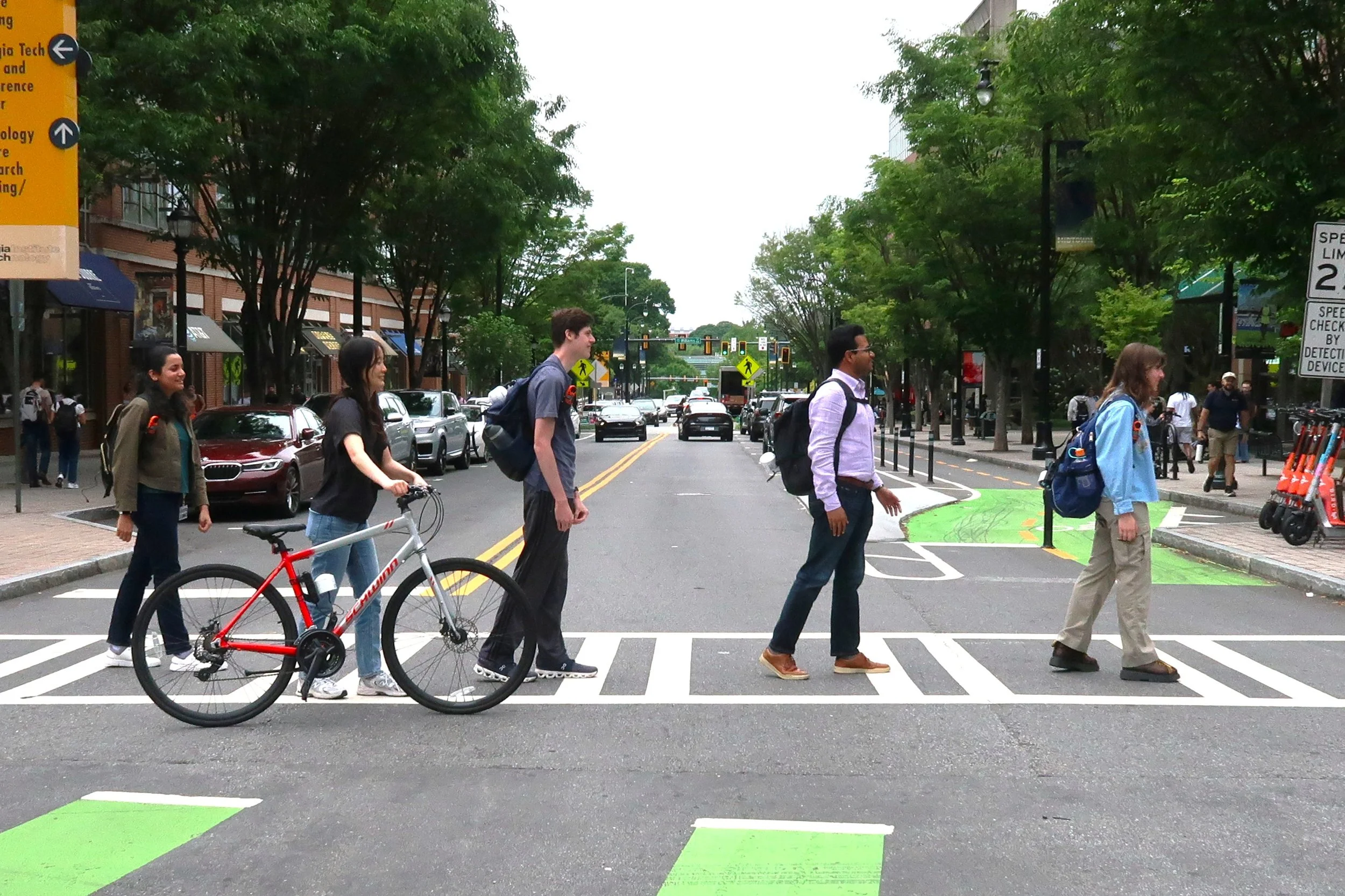
Turning Every Step Into Data Collection
“Every walk is data collection as a city planner,” said Rounaq Basu, PhD, an assistant professor in the School of City & Regional Planning at Georgia Tech. “You have a running list of observations, problems, and things that stand out.” Basu applies this mindset to his work on the Neutralizing Onerous Heat Effects on Active Transportation (NO-HEAT) Initiative.
NO-HEAT assesses heat risk, which is highest in places where both temperatures are highest, and people are spending time outdoors, including when they are using active forms of transportation, such as walking and biking, or waiting at the bus stop.
Atlanta faces unique challenges related to extreme heat, equity, and traveling on foot or by bike. “People who move around Atlanta outside of cars come face to face with extreme heat, but often lack shade or other infrastructure, such as bus shelters, that would reduce their exposure. And the burdens aren’t shared equally—there are generally more shade trees and bus shelters in wealthier, whiter parts of the city,” said Rebecca Serna, Executive Director of Propel ATL, a community advocacy organization.
The goal of NO-HEAT is to mitigate the negative impact of extreme heat and climate change on human health, including increased risks of cardiovascular events and early-term birth. As part of this work, university researchers, students, and community advocates are attaching temperature and air quality sensors to their backpacks and bikes to get on-the-ground data that will show where the city is hottest. Using mapped, modeled, and on-the-ground geospatial data, city planners can explore feasible, data-driven design changes to make cities cooler where they are needed most, and people can be empowered to find the coolest walking and biking routes as they move around the city.
Same Temperature, Different Experience of Heat
While temperature is a measurement we use every day to describe our environment, there are several ways to calculate it, and some calculations do not provide a complete picture. For example, in the United States, when you look at a temperature, you might be looking at a calculation called the Mean Radiant Temperature (MRT), which doesn’t account for humidity and wind. Or, you could be looking at the land surface temperature (LST), which is recorded by satellites or drones with a top-down view of trees and buildings that is not accurately related to how humans experience heat on the ground.
For the NO-HEAT Initiative, Basu is using a more nuanced temperature measurement, called the Universal Thermal Climate Index (UTCI). The UTCI includes air temperature, relative humidity, mean radiant temperature (MRT), and wind speed to provide a highly specific measure of thermal comfort that represents what a temperature really “feels like”. The UTCI is more accurate than both MRT and LST. “Using the UTCI and air quality data at a very high spatial and temporal resolution, we can differentiate between two sidewalks on opposite sides of the same street at different times of day,” said Basu, “We want to have heat and air quality data modeled that is at least at the sidewalk level to model, test, and make available to the community via an interactive application.”
What’s missing from the UTCI dataset to understand heat risk and its potential negative impact on human health is…people! Understanding where people move through cities on foot or by wheel as they pass by parking lots, parks, roads, and buildings is necessary to create a full picture of heat risk locations throughout the day and reduce the negative impacts of heat risk on people. “Our goal is to be proactive, to provide cities and people with tools they can use to change how they move through cities in the heat. Why should we wait for heat strokes or other health-related incidents to happen?” said Basu, whose research is affiliated with Georgia Tech’s Center for Urban Resilience and Analytics (CURA).
Putting Heat on the Map, for Every Sidewalk
To layer on-the-ground data to test the accuracy of the dataset and model, Basu’s research team, including approximately 20 undergraduate students gaining interdisciplinary research experience through Georgia Tech’s Vertically Integrated Program (VIP), and in collaboration with community members with Propel ATL are attaching sensors to their backpacks and bikes to gather temperature and air quality data.
Related to NO-HEAT’s collaborative work, Serna from Propel ATL said, “Georgia Tech’s commitment to working with community organizations makes its research more grounded in people’s lived experiences, and therefore more readily applied to policy changes. Propel is made up of people who want to move sustainability throughout Atlanta, so we bring the diverse experiences of people and their passion for change to the table.”
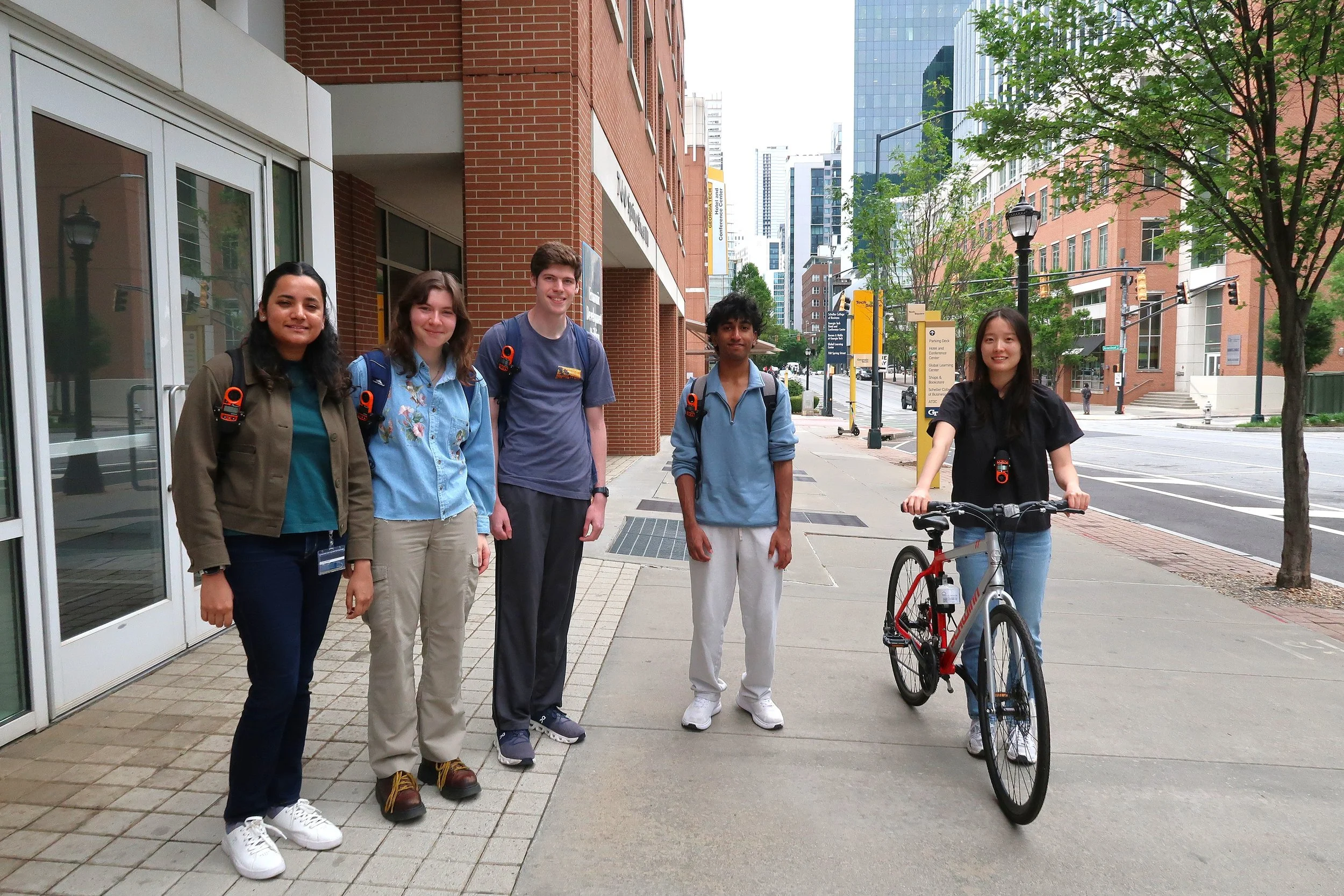



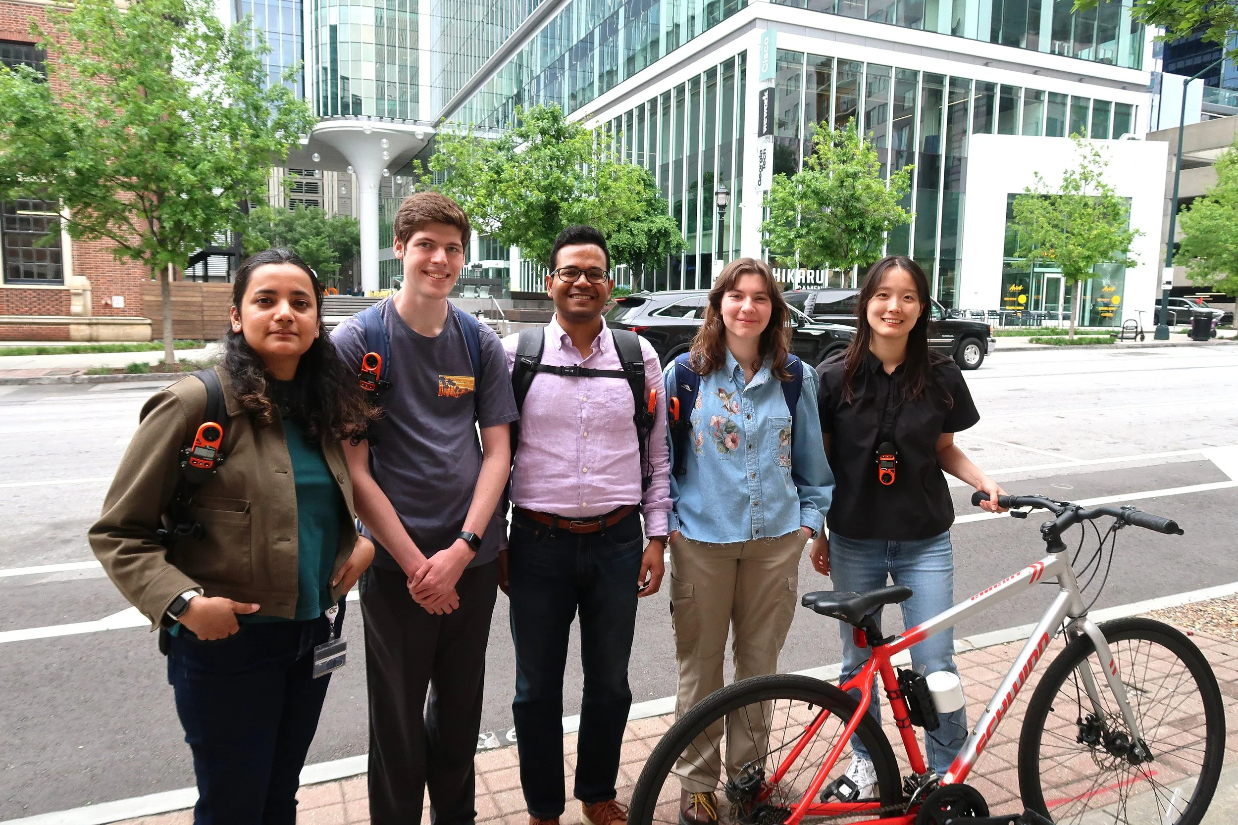


Temperature and air quality readings that are taken at ground level provide information about exposure where people are spending time, and traveling between, such as bus stops, rail stations, parks, schools, and commercial areas. “This is an equity issue that cuts across neighborhoods,” said Basu. “Heat, personal safety, health conditions, air quality, built environment, traffic safety. Each of these shapes your experience”.
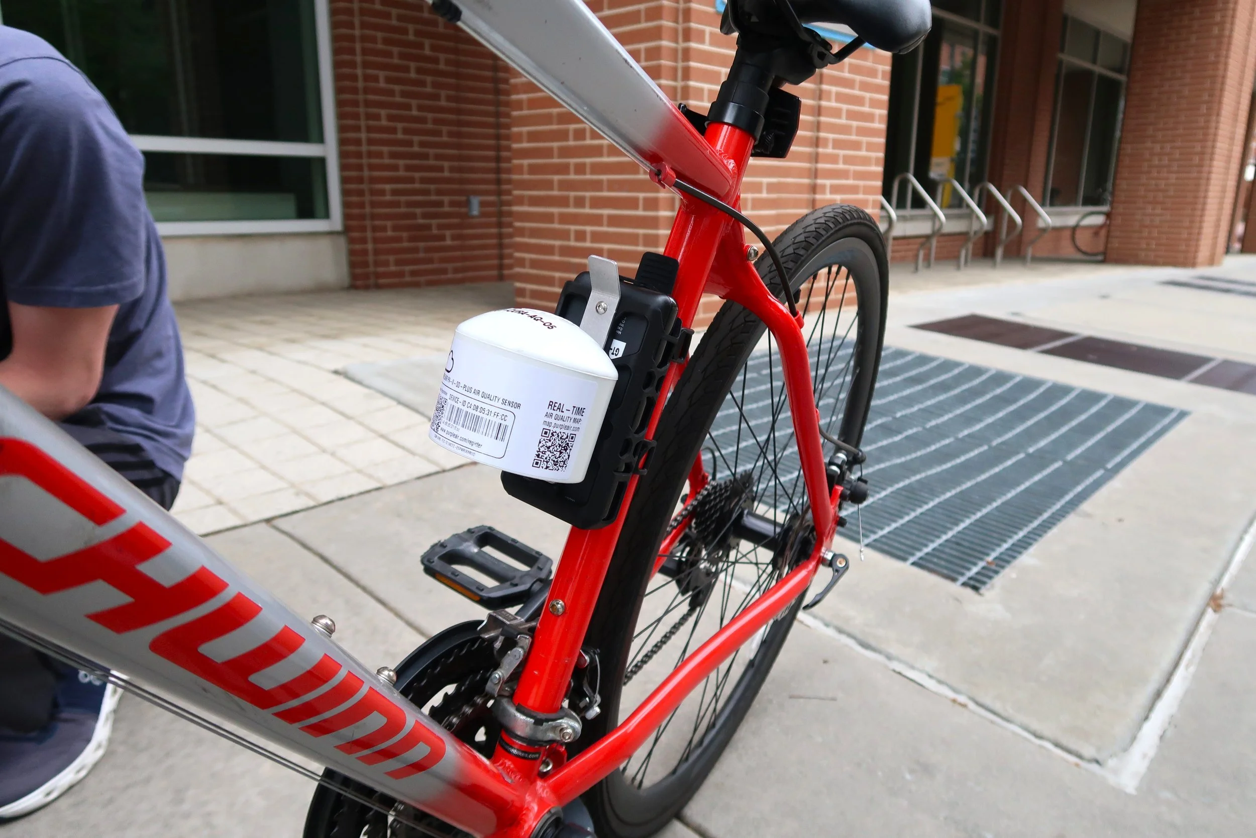
The Kestrel sensor, which is an orange device that fits in the palm of your hand, measures wind speed, air temperature, and humidity. For this sensor, Basu’s team designed a custom mount and cord to attach it to a backpack or bike. The Purple Air sensor, which measures extremely small, inhalable particulate matter (PM2.5 and PM10), was tested and upgraded from a stationary configuration to a mobile unit for use in the walk and bike audits. To do this, the team attached battery packs and designed a custom mount that ensured the Purple Air sensor remained upright for accurate measurements when in motion during walking and biking.
By walking on specified routes during the hotter months, the collected data will be used to check the team’s models. As a result, this “street-level” measurement provides a better understanding of how pedestrians are experiencing and making decisions related to heat. The first set of data collection was in September 2025, and the team, including volunteers from the community, is preparing to collect data starting June 2026. This data-driven approach provides communities with valuable insight. “We’ll be able to more effectively advocate for shared routes for transit riders and people walking, biking, and scooting,” said Serna.
Taking the Cool Route
With the sidewalk-level dataset mapped, Basu’s question is, “How can we adjust how we travel around heat and humidity?” To answer this question and empower those walking and biking, Basu’s group is developing a “Cool Routes” app that uses UTCI datasets to identify the coolest routes for bikers and walkers based on a variety of features. The Cool Routes app will allow individuals to find the coolest and greenest routes to minimize their risk of exposure to extreme heat, based on their exact location and time of day.
Basu’s vision for the future is that cities will be able to use these data to explore heat-mitigating interventions, and advocates will be able to use the data for their own communities and neighborhoods. For example, in Boston, in collaboration with the Boston Region Metropolitan Planning Organization (MPO) and other partners, Basu’s team installed shelters at four locations to mitigate heat as part of a pilot effort. “Local communities know their neighborhoods best and are experts on their own needs. Honoring that knowledge helps us engage with communities and neighborhoods, and understanding their priorities shapes ours,” said Serna on the impact of engaging with local communities for work related to safer streets advocacy.
“The goal is to change the way we think about moving through cities and navigate heat risk,” said Basu, who is conducting research at the National Center for Atmospheric Research this summer. “We are hoping to launch the Cool Routes app for all American cities hosting FIFA World Cup games in 2026,” said Basu. As a resource, the Cool Routes app can empower Atlantans and visitors to prioritize routes based on distance, heat, greenery, and safety for both walking and biking at different times of day.
The City of Atlanta is known to many for its car-centric culture. But it’s also known for its innovations in city planning, such as the Atlanta Beltline and the Historic Fourth Ward Park. With the sidewalk-level dataset in mind and the Cool Routes app in hand, people can find their coolest route. “We envision a city where heat exposure isn’t a barrier for people trying to walk, bike, or ride transit, and where these modes are as safe and respected as driving is today,” said Serna, related to Propel ATL’s vision for Atlanta.
What’s the Next Step for the NO-HEAT TEAM?
The next season of the NO-HEAT on-the-ground data collection collaboration between Georgia Tech and Propel ATL starts this summer. So, get your backpack, unlock your bike, fill your water bottle, and join the NO-HEAT team. Reach out to the team by email at remap.gatech@gmail.com if you’re ready to join the movement and turn your steps into data for change.