Find Your Coolest Route: Georgia Tech Launches App for 10 FIFA World Cup Cities
You’ve got your ticket and team jersey picked out, and you’re off to a FIFA World Cup match. But first you must get there. And despite the heat, many cities, including Atlanta, are encouraging fans to use public transit or walk or bike to get to the games.
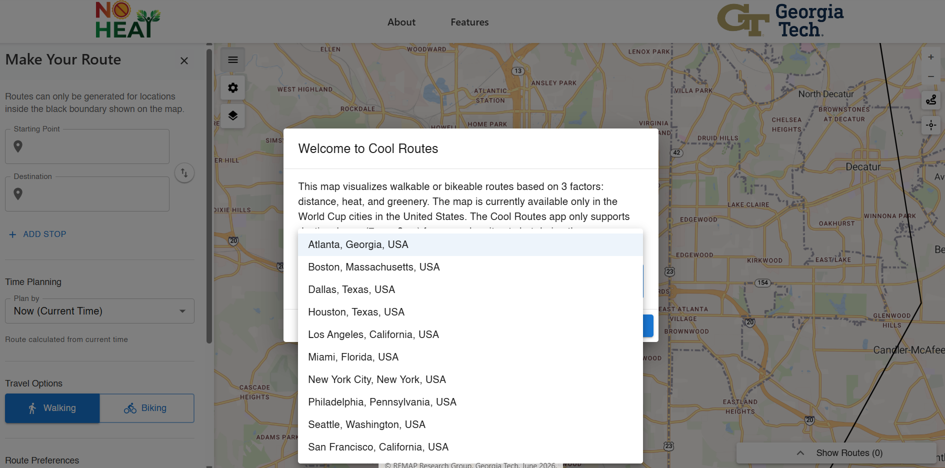
To help fans find the coolest, greenest, and fastest routes from nearby bus stops and train stations to the stadium, in June 2026 a team of Georgia Tech researchers launched the Cool Routes web app and mobile app in 10 U.S. cities hosting FIFA World Cup matches.
Extreme heat is not only uncomfortable, but it also has negative health effects, especially for people who are older, have existing medical conditions, or who work or spend a lot of time outdoors. This includes people who use active forms of transportation, such as walking, biking, or public transit. In Atlanta during the recent heat wave at the end of June and beginning of July, the heat index, which accounts for humidity, reached nearly 110°F.
“As of now, we are covering the entire city of Atlanta and a one-mile zone around the soccer stadiums in nine other cities hosting the World Cup, but the eventual goal is to cover those entire cities and many more,” said Rounaq Basu, PhD, Assistant Professor in the Georgia Tech School of City & Regional Planning and lead of the NO-HEAT Initiative.
Comparing Shortest, Coolest, and Greenest Routes from Tech Square to Mercedes-Benz Stadium
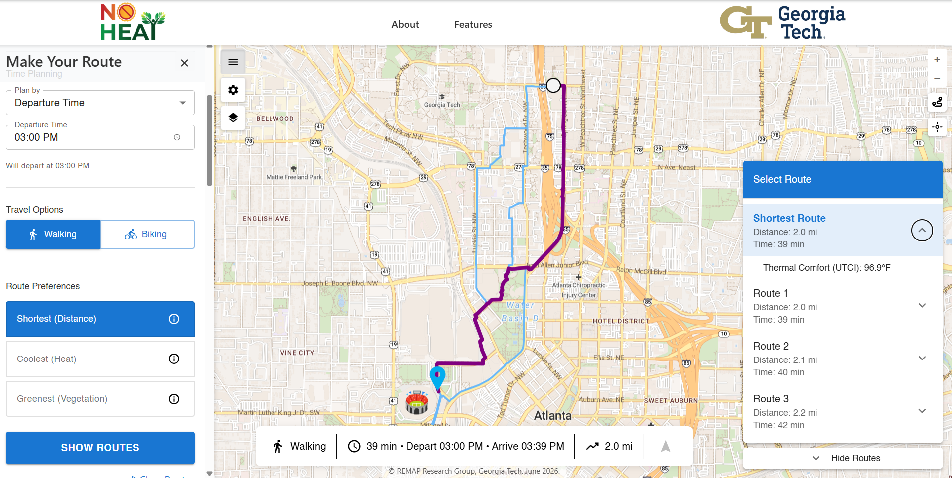
To start, in Cool Routes, select a location in the heart of Tech Square as the starting point and the Gate 3 entrance of the stadium as the destination either by clicking on the map or adding the address. Then, select the time of your trip. Here we’ll select a departure time of 3:00 PM, which is around the peak heat of the day and when many FIFA matches are starting or letting out.
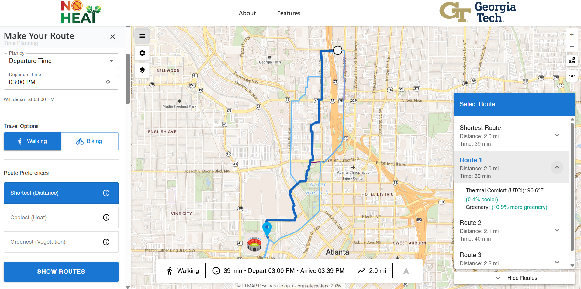
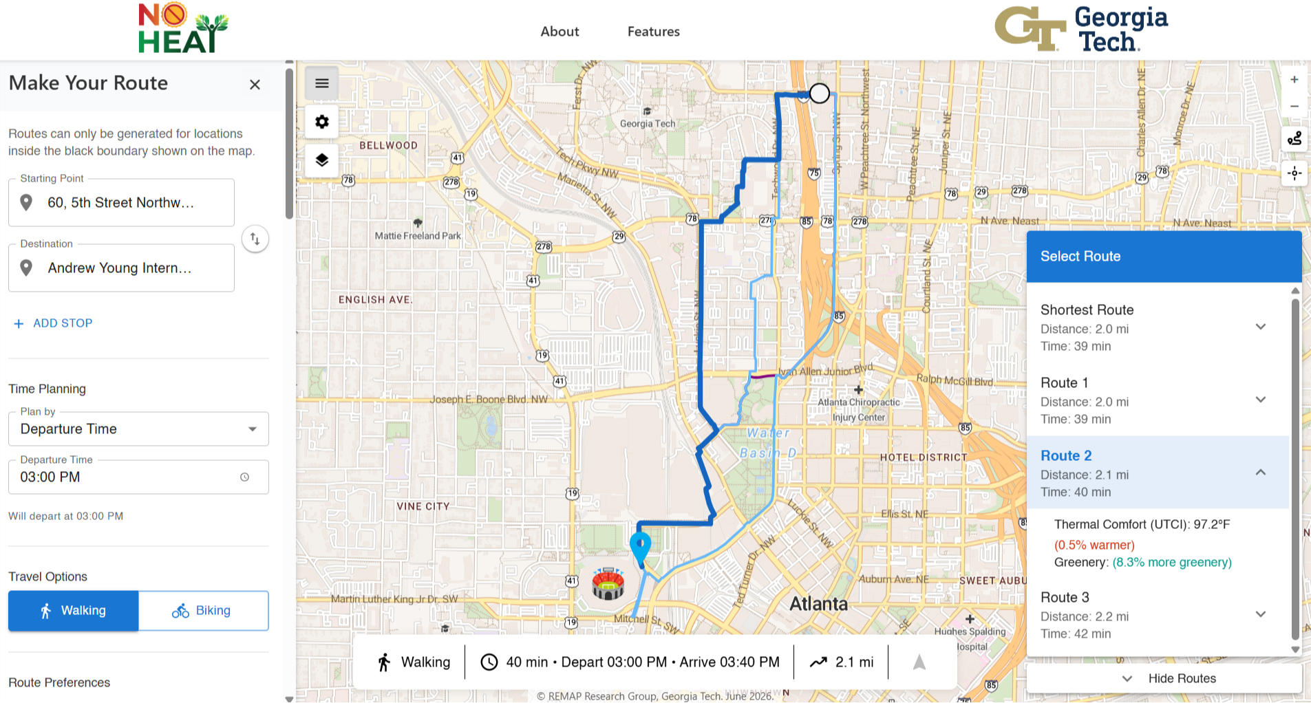
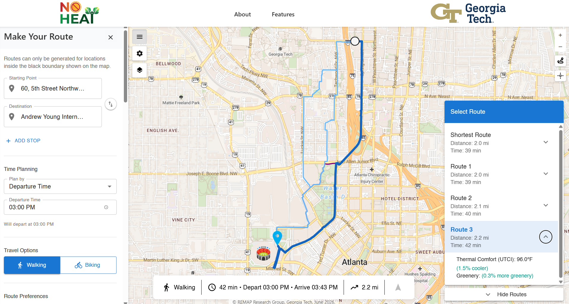
In the Cool Routes app, with walking as the travel option and the coolest route (shortest and greenest are also options) selected, you can see on the map how three alternative routes compare to the shortest route, which is 2.0 miles and estimated to take 39 minutes, with a thermal comfort of 96.9°F (Directions retrieved on July 8, 2026).
In this example, Route 3 is the coolest, but it is also the longest and has marginally more greenery than the shortest route. This highlights the impact of microclimates and the built environment. Route 3 travels through midtown and downtown Atlanta on the way to the stadium. The slightly cooler temperature for this route may be due in part to afternoon shade from buildings and to the fact that a large portion of this route passes by Centennial Park, which is cooler due to its green land cover compared to asphalt or concrete.
For this 3 PM walk from Tech Square to Mercedes-Benz Stadium, Routes 1 or 2 may provide the middle ground, offering nearly the same trip time as the shortest route while being significantly greener. Route 1 could be the top path to take as it is the same travel time as the shortest route, marginally cooler, and the greenest, passing through Georgia Tech’s campus. The day and time of your search in Cool Routes will affect your results due to sun and shade.
And while directions similar to Route 3 are shown on Google Maps for walking routes, Routes 1 and 2 are not shown as initial options when using the same starting and ending address.
Pairing the Cool Routes options with Google Maps Street View can help residents, tourists, and fans alike optimize their walking, biking, and transit trips around the city.
Next Steps for Cool Routes: Ground-Truthing Data
After launching the Cool Routes app, the NO-HEAT team is ready to take the next step with community members to make Atlanta more resilient to the dangers of extreme heat.
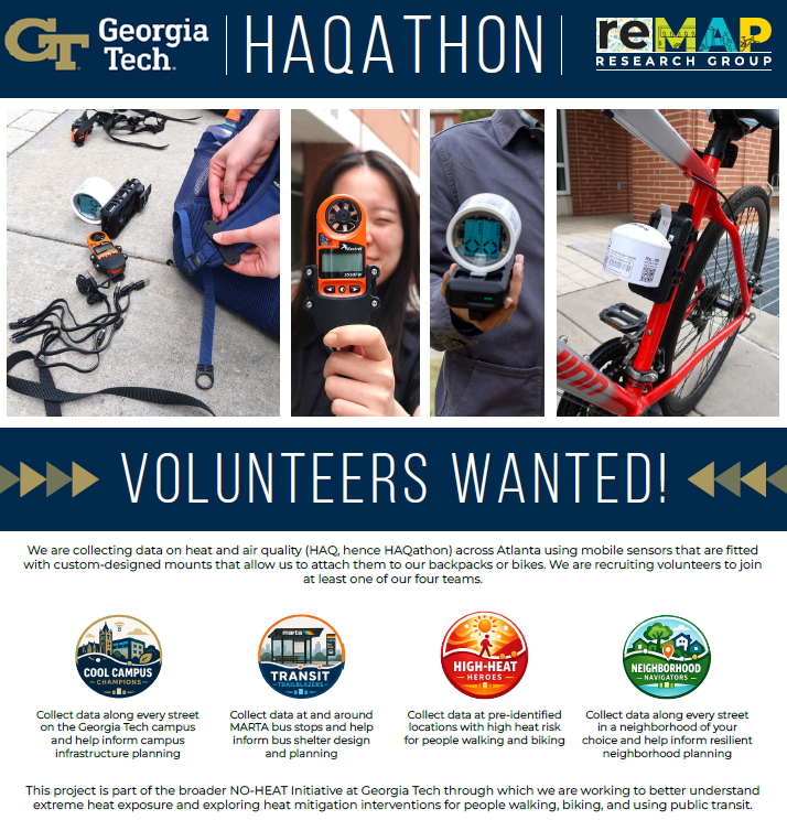
The NO-HEAT team currently has an open call for volunteers who will attach heat and air quality (HAQ) sensors to their backpacks and bikes for the NO-HEAT HAQathon.
The goal? To get data on the map for as many streets as possible across the City of Atlanta. This phase of the project provides on-the-ground data that will refine the accuracy and usefulness of the Cool Routes app.
By turning every step into data collection, you will help Atlanta city planners identify where shade or greenery is most needed in our neighborhoods, especially as extreme heat events become more frequent and intense.
“This project is part of the broader NO-HEAT initiative at Georgia Tech, through which we are working to better understand extreme heat exposure and exploring heat mitigation interventions for people walking, biking, and using public transit,” said the NO-HEAT team on the HAQathon flyer.